
Project Baseline is glad to inform that the first monitoring station was installed on the Osborne Reef on July 14, 2013. The first station is actually what will be referred to Station 8 on the Osborne Reef as this refers to the Broward County map of the Reef (see Below).
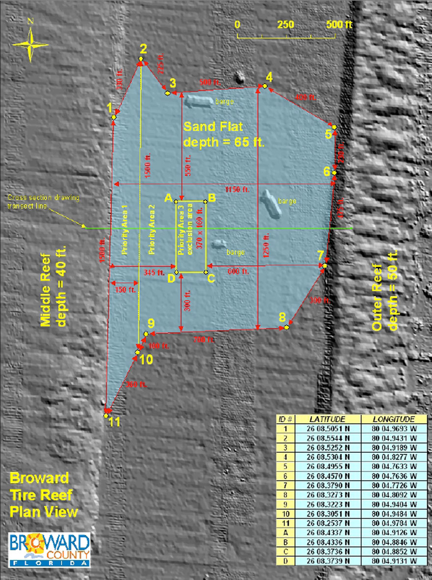
The Osborne Tire Reef Map from Broward County in connection with 2013 tire abatement proposal request
Made up with an iron bar drilled into the sand bottom to anchor the float that is made up of PVC piping, the station will provide a stationary point from which to monitor any development of the conditions of the area. The float which hovers 10 feet off the bottom will provide a very specific point from which to capture still shots and videos of the area and of specific points, so that sound comparisons can be made over time and time lapse still shots can be put together.
This information may become very valuable for scientists, policy makers and others who shares the interest of the development of the health of the ocean.
The dive team, consisting of Robert Carmichael and Ted Cole, captured some still shots of the installation:
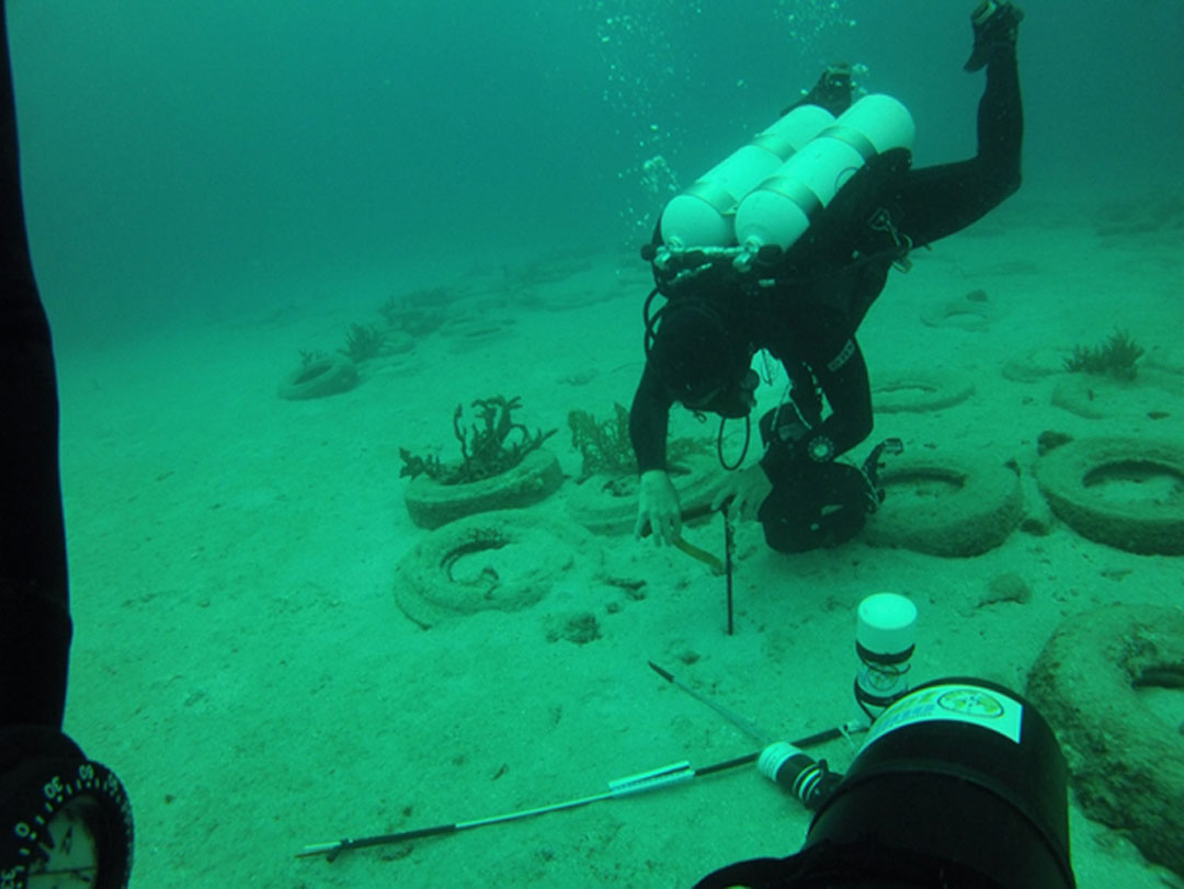
The anchor point for Station 8 at the Osborne Reef is being drilled into the sand bottom
The vertical line that will hold the float is being attached
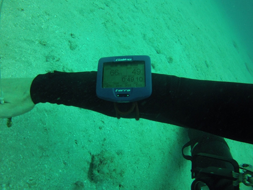
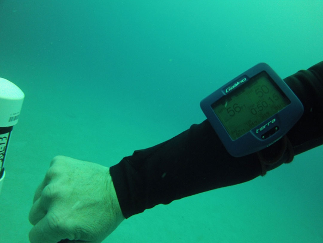
The sand bottom at the Osborne Reef is 66 feet deep
The float hovers 10 feet above the sand bottom
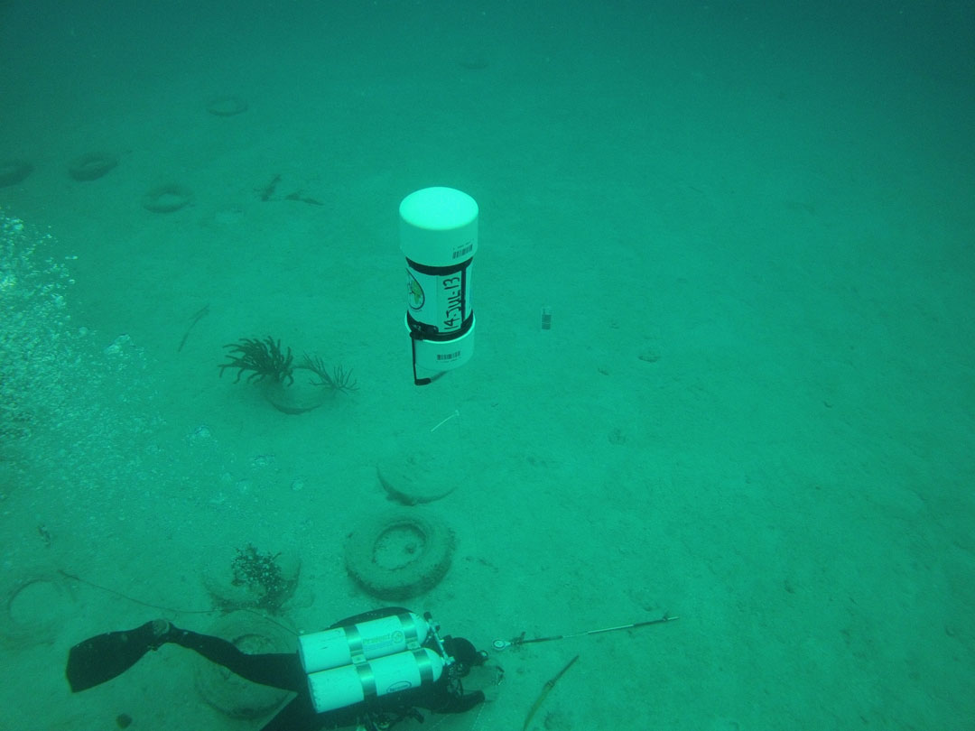
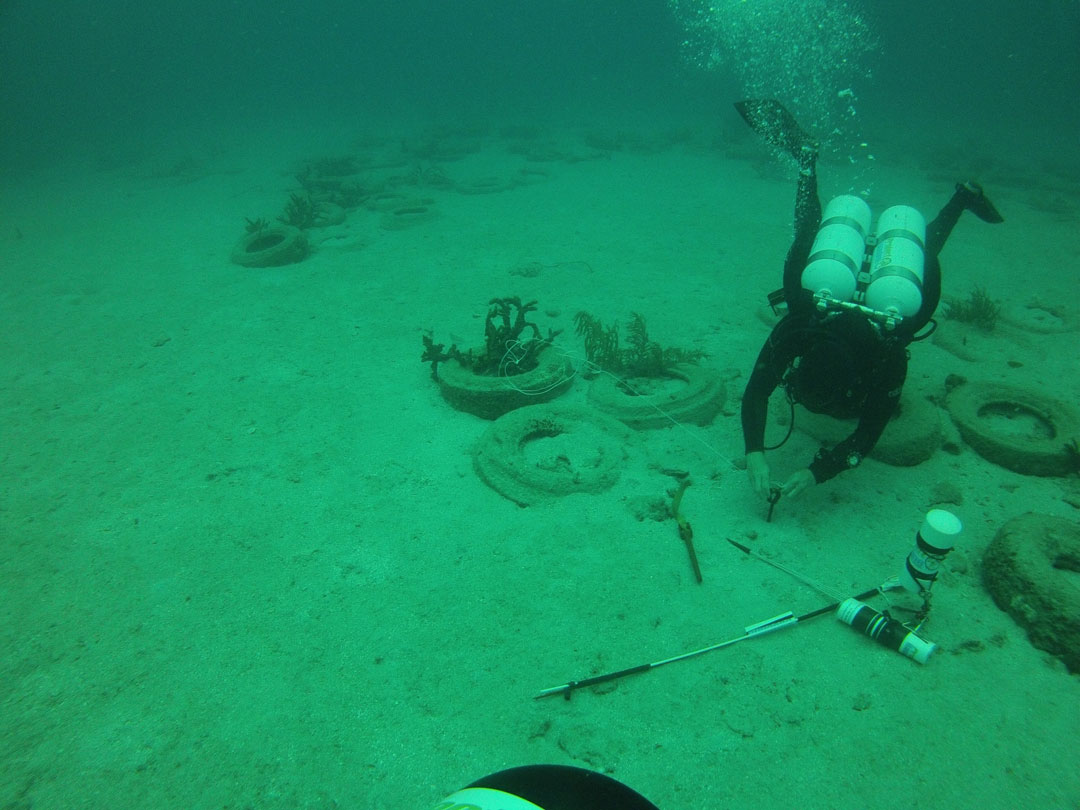
Diver finishing up the installation of Station 8 at the Osborne Reef.
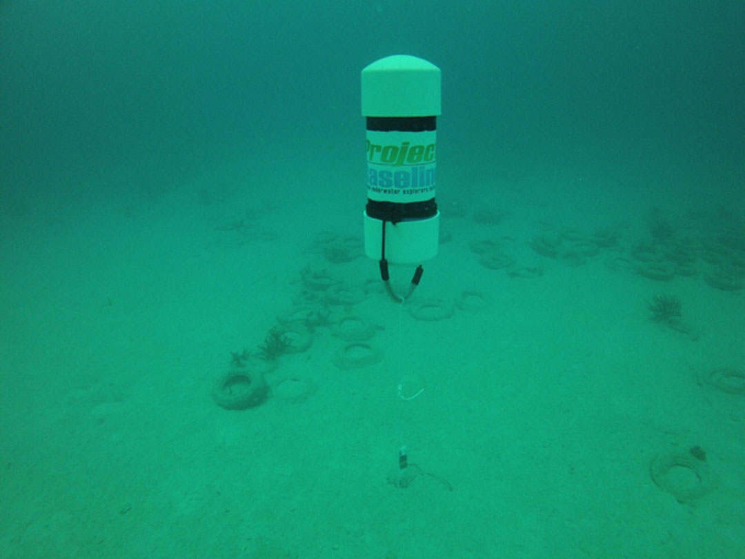
Installed float provides a great reference point
Should you who is reading this post ever dive at this location and have video camera or still shot camera with you, then please grab some footage/images and share with us. This is the purpose of these monitor sites and we would love to have you engaged in the activities too.