
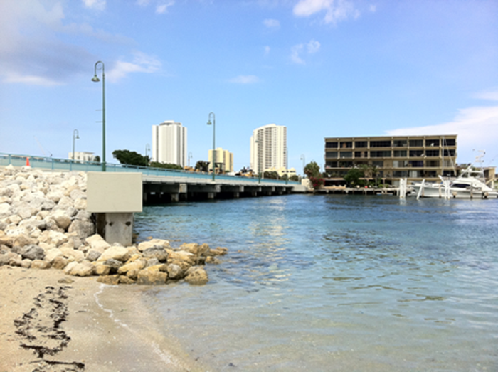
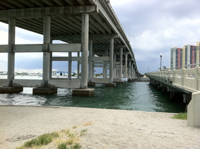
The Blue Heron Bridge (BHB) is the premier shore dive site in Palm Beach County. Formally known as the Jerry Thomas Memorial Bridge; it is a causeway that connects Singer Island to the mainland via Blue Heron Boulevard. The actual site lies underneath the bridge itself adjacent to Phil Foster Park.
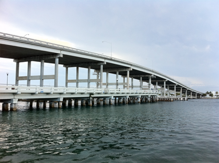
The dive site actually comprises of three sections: the East, the West site and the artificial reef/snorkel trail.
The East Site is on the eastern side of the park closest to Singer Island itself. This is the smaller section of the dive site; it takes approximately 20 to 30 minutes to fully explore with a maximum depth of 20 feet.
The West Site is the more popular and most dove section of the dive site; it takes approximately 45 to 60 minutes to fully explore this site with a maximum depth of 20 feet.
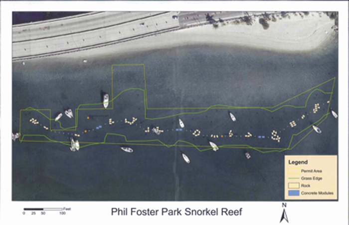
The Palm Beach County’s Department of Environmental Resources Management and Parks and Recreation Department commissioned and completed the artificial reef/snorkel trail in July 2012. The trail is approximately 800 feet long and runs parallel to the shore. The trail consists of rocks, prefabricated reef modules and existing structures with a maximum depth of 15 feet.
The Blue Heron Bridge has become a well-known se to divers all over Palm Beach County, Florida, the United States and worldwide. It attracts divers of all skill levels and interests from Open Water students to avid photographers. Part of the attraction to the BHB is the diversity of marine life that can be found and its ease of access.
Water temperature can vary dependent on the time of high tide and season. In the summer average water temperature can range from 78F to 85F; winter temperature can range from 70F to 75F. Visibility is dependent on time of entry. Divers should enter the dive site at high slack tide: preferably 30 to 45 minutes before the tide visibility is dependent on it. Visibility can range from 10ft to 40ft dependent on the amount of rain runoffs, amount of other divers in the water, debris, and tidal flow.
The Blue Heron Bridge is renowned for it’s diverse marine life that can be found in such a small area. Marine life ranging from invertebrates such as octopi, spiny lobsters, banded shrimp, arrow crabs, moray eels, pillow starfish and fish such as balloon fish, puffer fish, scorpion fish, grunts, butterfly fish, angelfish, spadefish, toadfish, filefish, flounders, barracudas, blennies, gobies, the rare spotted gurnard, seahorses and large marine life such as spotted eagle rays, southern sting rays, and even occasional manatees.
However, the Blue Heron Bridge is experiencing some environmental concerns. One of the most major concerns for the site is water quality. Since the BHB is located within the Intracoastal Waterway (ICW) it is subject to water run off and discharge from local lakes and other on-land sources at a much higher rate then an oceanic reef. Thus this unique location of the site creates some challenges for the marine life that inhabit this area and ecosystem. Recently a dive was performed from members of Project Baseline Gulfstream highlighting some of these issues.
This video was taken on the southern side of the dive site adjacent to the boat pilings. As you can see from the video there is a discoloration in the water stemming from recent run off from rain, lake discharge and other sources this video was taken two days after some recent heavy rain. If you pay attention to the bottom of the pilings you can see foreign debris collecting. This is mostly aggregate sand and material from dredging activities in the Lake Worth inlet.
The Blue Heron Bridge is a monitoring site of Project Baseline Gulfstream. Our goal is to document and report our findings to provide empirical evidence about the overall health and development of this site.
We encourage all divers to share your dive reports, measurements, findings, photos and videos with the community and us. Project Baseline is a non-for-profit initiative encouraging all to participate in the data collection and monitoring of sites. Please reach out to us and contact us to inquire further.