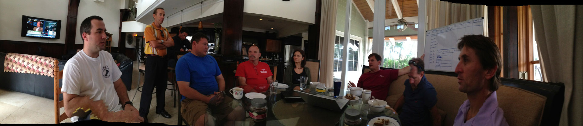
A number of divers, including the initial members of Project Baseline
Gulfstream Chapter as well as some fresh new members, met up at Robert
Carmichael’s house to discuss ideas for Project Baseline. Robert
Carmichael is one of the Founders of Project Baseline and of its
Gulfstream chapter. Topics discussed included how to progress with the
Gulfstream chapter, methods and systems to effectively collect data,
what data to collect and how to rank quality of data,
Honoring us with his presence was Dr. Todd Kincaid who Project Baseline’s Vice President & Science/Conservation.
Dr. Kincaid is also GUE’s (Global Underwater Explorers) vice
president and science director, he earned B.S. and M.S. degrees in
geology and hydrogeology from the University of Florida in 1991 and
1994, and a Ph.D. in karst hydrogeology from the University of Wyoming
in 1999. He has a diverse background in geology and hydrogeology and has
extensive knowledge of karst hydrogeology.
His experience includes: quantification of groundwater/surface water
exchange; groundwater tracing using isotopic and artificial tracers;
environmental site characterizations and remediation; aquifer
characterization; and modeling complex geologic environments. Dr.
Kincaid is currently managing a groundbreaking aquifer characterization
study of the Woodville Karst Plain of north Florida with the Florida
Geological Survey and the Florida DEP, which synthesizes groundwater
tracing, cave mapping, and hydraulic data into one of the first
numerical models that truly embraces karst complexities (www.geohydros.com/FGS).
He has authored several professional reports as well as numerous
professional and academic papers for national and international journals
and symposia. He regularly participates in meetings with local and
state agencies as well as legal proceedings to convey modeling results
to regulatory and lay audiences.
He has been passionately exploring caves since 1987 and has worked to
protect underwater caves and springs since 1992. He has been with
Global Underwater Explorers (GUE) since its inception in 1999.
Having Dr. Kincaid present to share his insights on the best
practices for scientific data collection was very helpful as was getting
further updates and news of other parts of the Project Baseline
endeavor from other chapters.
We had a great discussion about the project and we are all very excited about moving the initiative forward.
The initial plan for data collection includes collecting the following data:
Date (of data collection)
Latitude & Longitude (“station” location)
Dive log (including average depth and run time)
Temperature (Surface and bottom temperature)
Visibility
Sighting
Anomaly
Image (and image location)
Video
In a perfect world one would probably collect the specific dive log
from one’s dive computer as it would give a very specific profile of
time, temperature and depth. This specific data could prove very
valuable as it accumulated over time.
The group, however, also recognized that potentially getting
everybody who is kindly volunteering to gather data to actually download
their dive computer and then supply this material, may not be
altogether too likely. So a second best would be at least to aim for
collecting the data of the surface temperature as well as bottom
temperature from a dive.
It would also be good to make a note of which dive computer was used (make and model).
Now for the topic of judging visibility, team members recognized that
individuals’ judgements of distance and visibility tend vary greatly
even from the same dive. So, ideas on potentially installing certain set
points at specific measured distances (numbered plaques, Secchi Disks
and such) and similar ideas were discussed and are under consideration.
One conclusion was, that the good old knotted line (such as a cave line) on a reel would probably always work.
Sightings would include potentially counting fish and other species,
making note of growth presences (coral and other types) and other
noteworthy sightings.
Anomaly could include sand having shifted massively, growth or death of coral, observable changes to site areas, etc.
For image collection over time to be particularly useful, it would be
a good practice to have certain specific spots identified for each dive
site (known as stations). These set points would identify repeatable
locations for photographic data collection (preferably from much the
same position, distance and angle).
In other words it would be beneficial to make note of specific
features of a dive site, e.g. an anchor or some distinct structure of a
wreck, a coral head from a reef or such, and make this the object of the
still images to be taken over time.
Having a Project Baseline specific marker to place at dive sites has
been on the drawing table from Project Baseline’s initial phases too,
but this idea is subject to budget, accessibility and feasibility for
such to be placed at individual dive sites.
Photo mosaics by computer programs such as Panorama Maker to be made
could also prove invaluable if such would be feasible to make on a dive
site.
Video taking is highly encouraged, but whereas the still images
should include at least some images on each dive at specific observation
points for each dive site, then videos would probably be more of a
general impression tool for a specific dive at a specific point in time.
A video would be able to capture visual impressions of several factors,
such as visibility, changes to a site over time, presence of fish and
species, growth, anomalies, conditions etc.
It is suggested that each site would have its manager, i.e. someone
who takes ownership of project coordination, data collection and
reporting. Without ownership being taken, good intentions often lead to
nothing being done.
Presently, videos are to be hosted at Youtube and images at Picasa.
Project Baseline Gulfstream has accounts with both.Vannessa, Project
Baseline Program Manager, is available via Skype conference to explain
the photo upload process.
Although Project Baseline is a GUE initiative, every team member is
aware that the endeavor is neither commercial or has any affiliation
with brands nor methodology or philosophy of diving.
The hopes are to collect precise data that can be shared freely for
scientific purposes and provide insights to the gravity of human
interaction for our waters around us. This data can demonstrate the
effects of pollutants, irrigation, farming, production, sewage handling,
fishing methods, dredging and much more.
Such insights could give us knowledge about what action is needed,
what needs to be stopped, what is worsened, what is improved. Thus it is
our hope that Project Baseline could potentially lead to better
management, policies and technologies over time.
Team members also agreed that there is a much greater need for data
collection than the small team of 10 gathered last week can achieve and
thus we are very hopeful that we can recruit anybody who is capable and
willing to collect date and report.
To underline this point, is it important once again to stress that
Project Baseline is not a commercial effort and is thus not affiliated
with particular dive stores, brands, manufactures etc. Project Baseline
welcomes all and encourages all.
(Thanks to Kathy Dicker for feedback and input to this post)