
Saturday June 15th 2013, the Global Underwater Explorer divers did another survey dive on the Osborne Reef for Project Baseline. 4 divers – Robert Carmichael, Paolo Passalacqua, Mikkel Pitzner and John Adair – were in the water and all carried video cameras, Mikkel Pitzner in addition brought the SLR camera for still shots.
The dive team followed the Southern, Eastern and Northern perimeter of the Osborne Tire Reef beginning at point “11″ (on the Broward County Tire Reef Map – see below) heading East-ward and then roughly followed the perimeter North and over to the West again.
In an effort to better understand the density and migration of the tires outside the bulk zone, the dive plan included an exact 5-minute run on the HDV’s set at ~150 feet-per-minute on a predominately due west heading. The goal on the final 5-minute run was to record the frequency and pattern of tires “on the run” at the northern extreme of the tire field. Our previous dive from 18-May included a similar due west survey beyond from point “1″ for a duration of 25-minutes. The tire density pattern appeared to be much greater in the earlier dive and culminated in a reservoir of tires in and around the 18-foot reef (Fishermen’s Pedestal).
Click here to view the report/story from the May 13th 2013 Survey Dive.
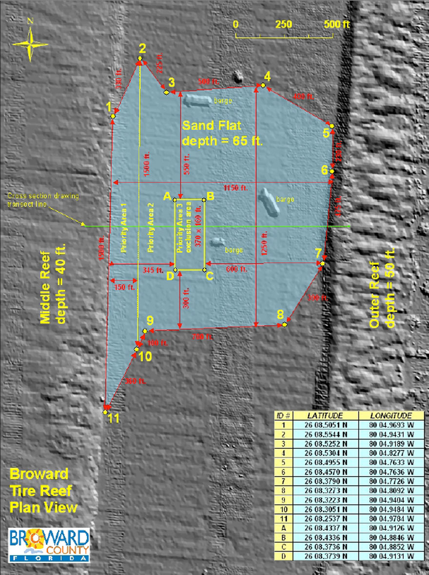
The Osborne Tire Reef Map from Broward County in connection with 2013 tire abatement proposal request.
Lots of video was captured and this will be published soon, including possibly a full length video of the stretch of the perimeter that the team dove.
Here’s just a small preview of what is to come: